The tallest mountain 🏔️ in the world is not really the tallest mountain in the world.
Ask anyone what the tallest mountain in the world is, and you will hear:
“Mt Everest”
Side Note
Just a tangent - this isn’t what the mountain is called by the people who live by it —
It’s 2 real names are:
Tibetan: ཇོ་མོ་གླང་མ - Chomolungma - Meaning “Mother of the world”
Nepali: सगरमाथा - Sagarmāthā - meaning “Forehead of the sky”
The name as we know it started as part of the British Great Trigonometrical Survey where “Peak XV” was determined to be the highest in the world. The Surveyor General of India - Andrew Scott Waugh - proposed naming it after his predecessor - Sir George Everest, simply because he thought a consistent name was needed. Both Tibet and Nepal were closed to visitors, meaning a local name couldn’t be verified. George Everest objected to this as he preferred local names.
So the worlds tallest mountain is named after a person who has never been near it or seen it and who didn’t want his name to be used for it.
Anyway I’m here today to tell you that it is not actually the tallest mountain.
Prominence
Prominence is a better measure of mountains than absolute height, because it measures them against the next tallest peak. How tall relative to the saddle determines it’s prominence.
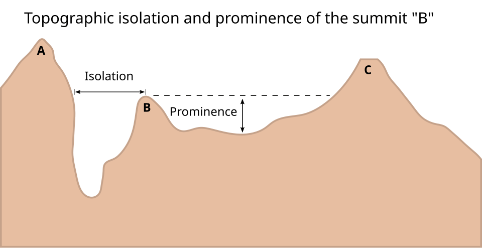
It is essentially a measure of how far a peak sticks up compared with the next tallest thing.
But by that description, Everest is still the tallest, since there is no taller peak on earth to compare it to.
Local Relief
Mountain climbers mostly care about a mountain’s relief - or the height they will actually be climbing up.
Draw a circle around a mountain summit at some arbitrary distance. Find the lowest point along it’s circumference, and then measure that against it’s summit.
This is it’s “Local Relief”. While closer to finding a mountain’s true height, it is still not the full picture since the circle’s diameter can be chosen arbitrarily. You could pick a radius that contains a deep gorge to exaggerate the relief.
Regardless, It can still be useful for comparing mountains to one another in specific scenarios.
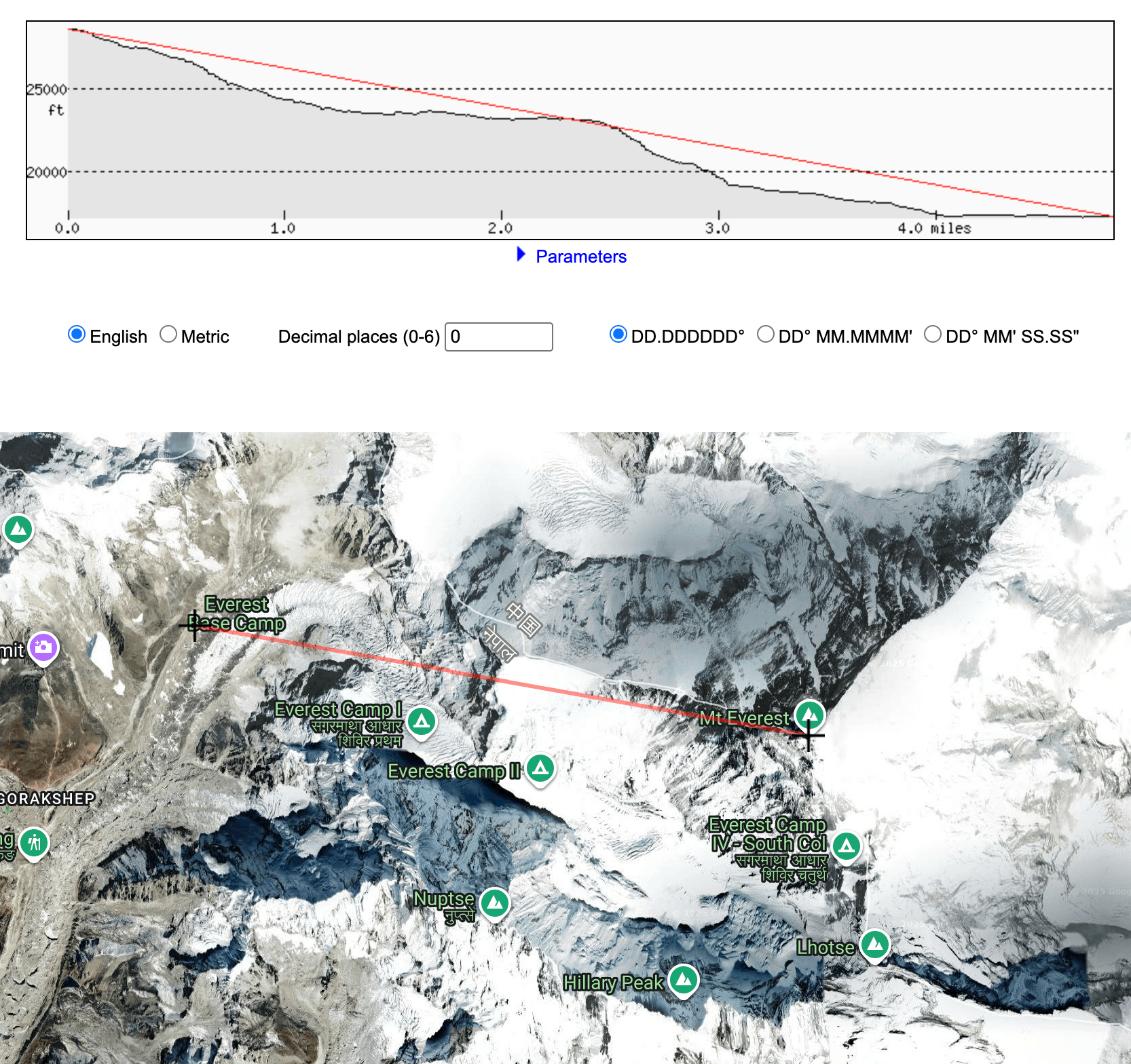
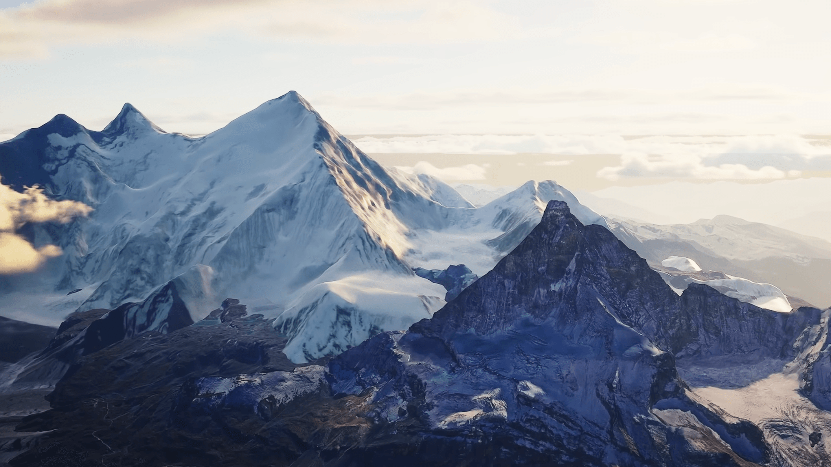
Lets look at the local relief of a few mountains with a radius of 10 miles. This will give us a standard distance to look at mountain profiles.
| Everest | Denali | Rainer |
|---|---|---|
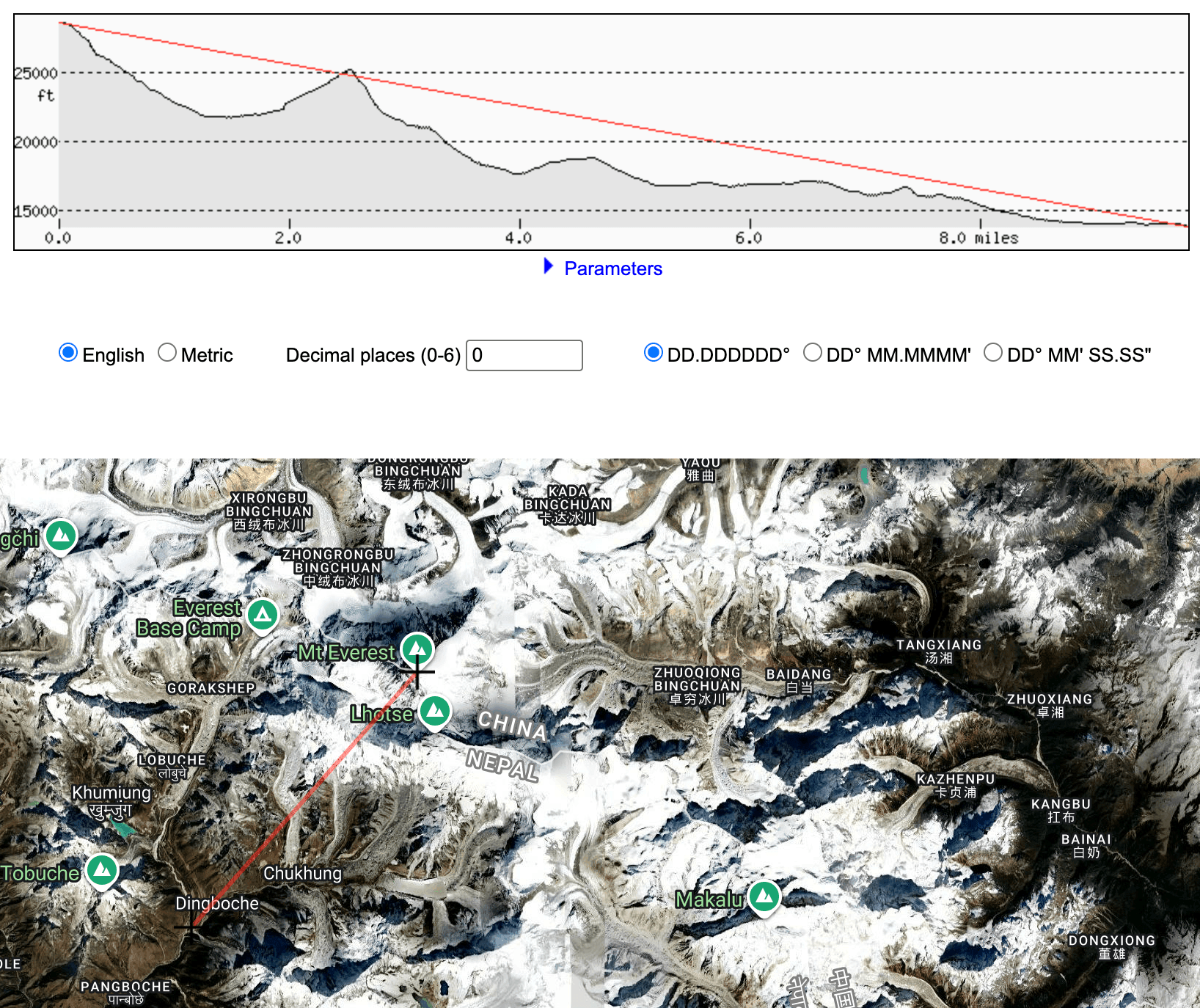 | 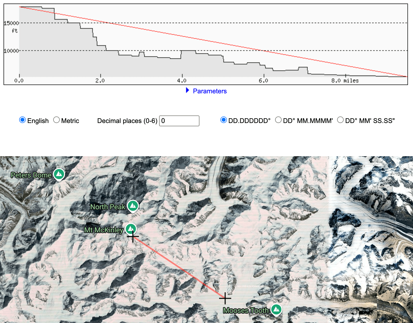 | 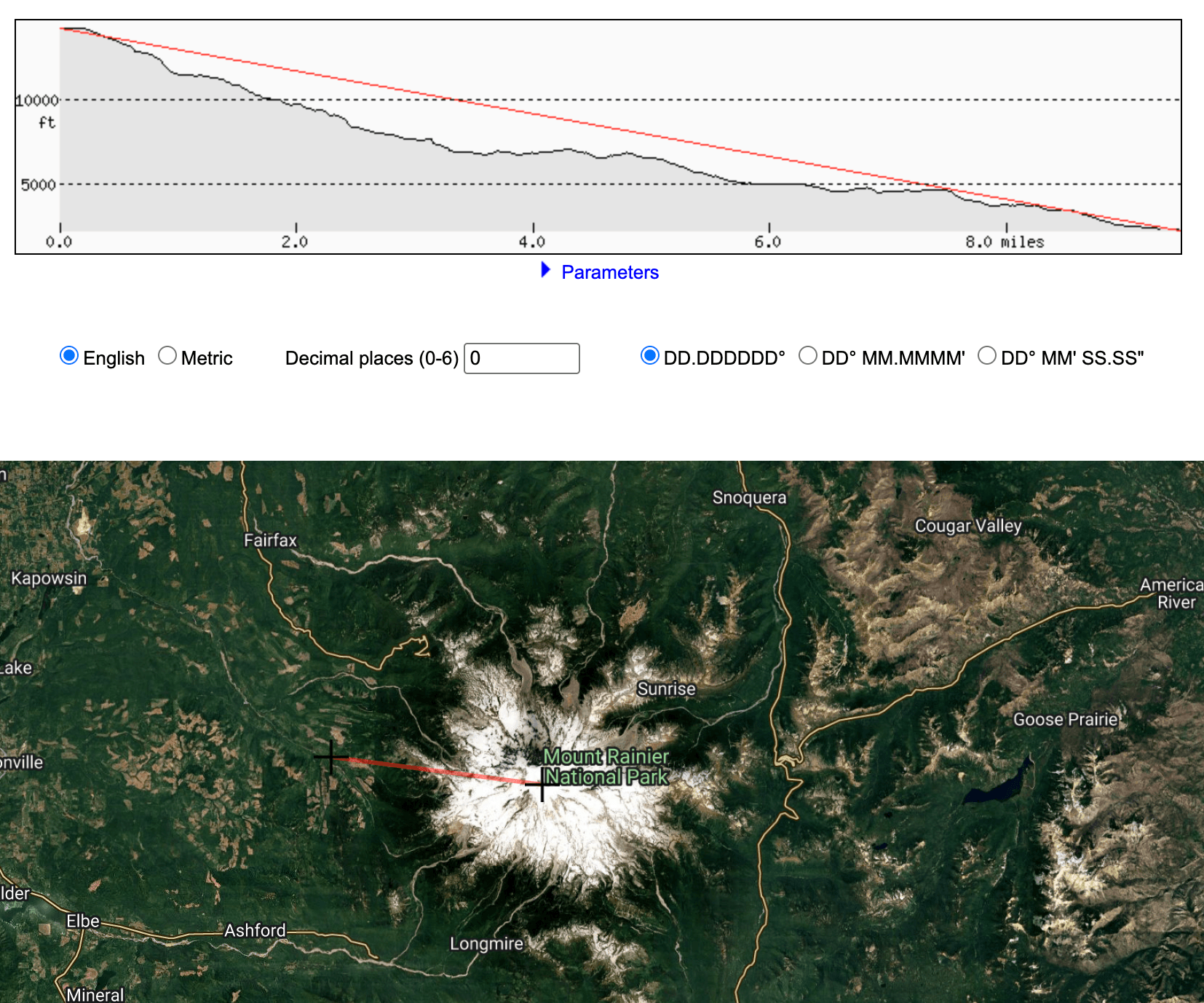 |
By the way, I just randomly choose places that looked lowest. These could be totally wrong. Just pretend to make a point.
We can now compare things like steepness and height. The three mountains I choose are actually all surprising similar at 10 miles, despite haven’t very different absolute heights (Everest is twice as high as Rainer).
Base-to-Peak Relief
When we look at a mountain, the size of it is determined from where it starts on the ground up to the top. If you take that same mountain, and put it on top of a huge plateau - the mountain is still the same size. I wouldn’t be taller for standing on a building. It just starts from higher up.
This is the measurement I am most interested in and is Everest’s grand trick. It’s actually part of the rim of the Tibetan Plateau. There are lot’s of other mountains all around Everest of similar heights. Are all of these mountains simply part of Everest?
By using Everest’s absolute height, you would need to extend this coverage to all of Asia, Europe, and Africa and include it as Everest’s base. When sitting in Paris, you are actually on Mt. Everest!
This is obviously ridiculous, so we try to decide where a mountain’s base is in the most objective way we can.
Wheres the base?
This is an important distinction, and can be a bit subjective, so there are a few defensible rules people follow when trying to decide:
- Toe-of-slope
Where a mountain meets the flat ground, and there is a break in it’s slope.
Generally a 5% - 8% change in slope is used
Take the median elevation along this edge - Adjacent Valley Floor
Take the nearest continuous low ground and measure against that - Connectivity
The base must be downslope of the mountains foot without crossing a higher divide
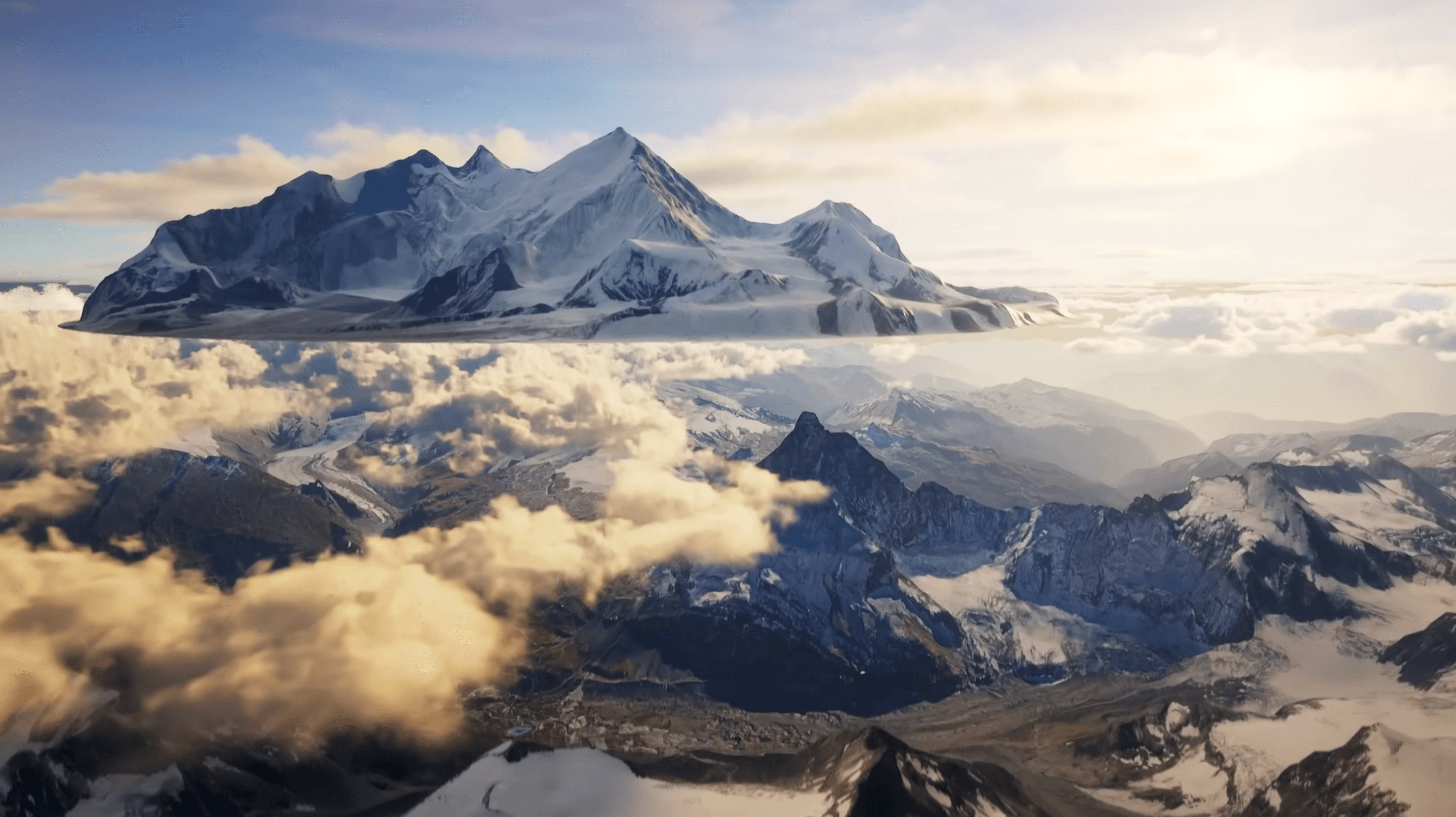
Comparing mountains
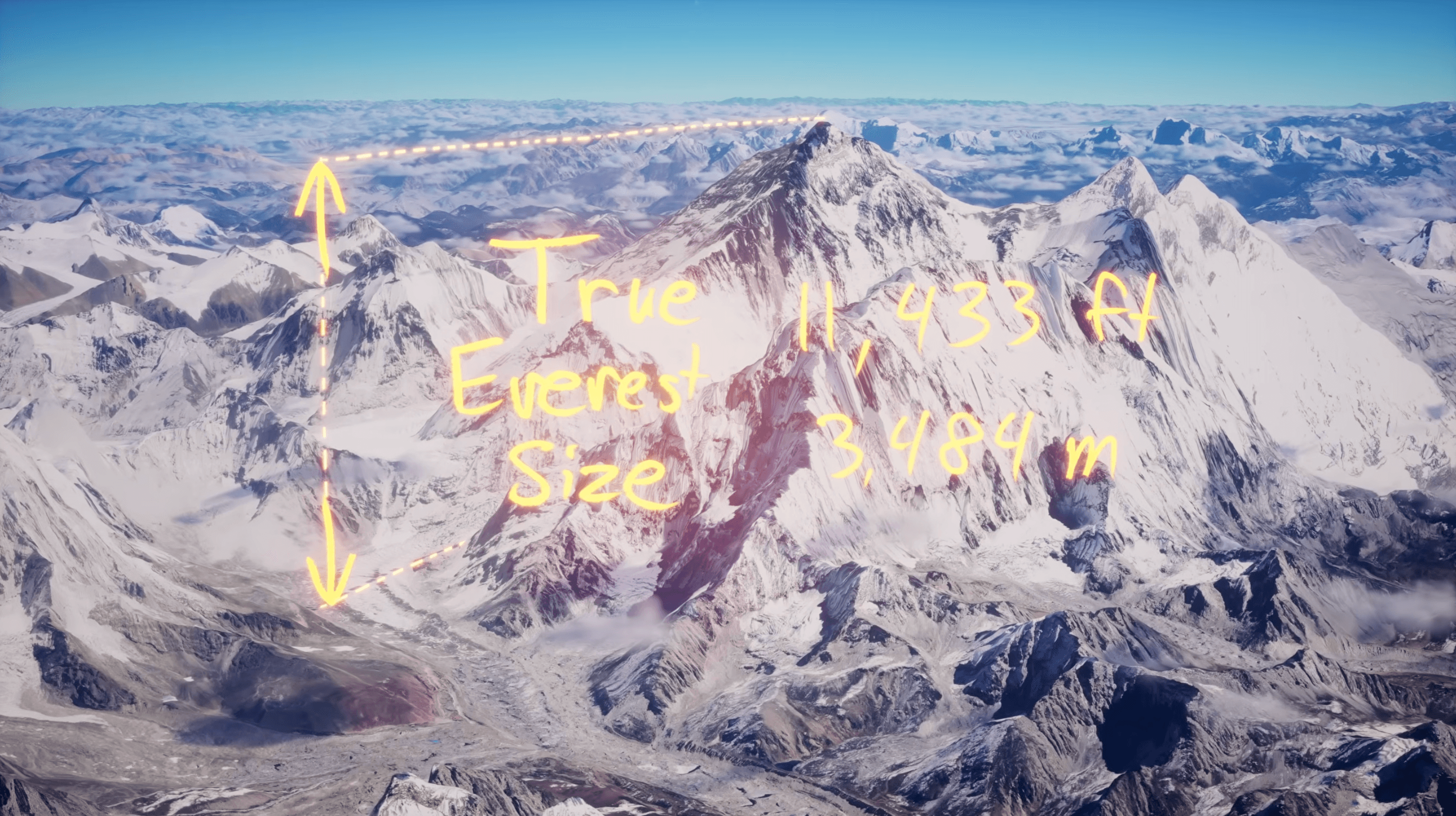
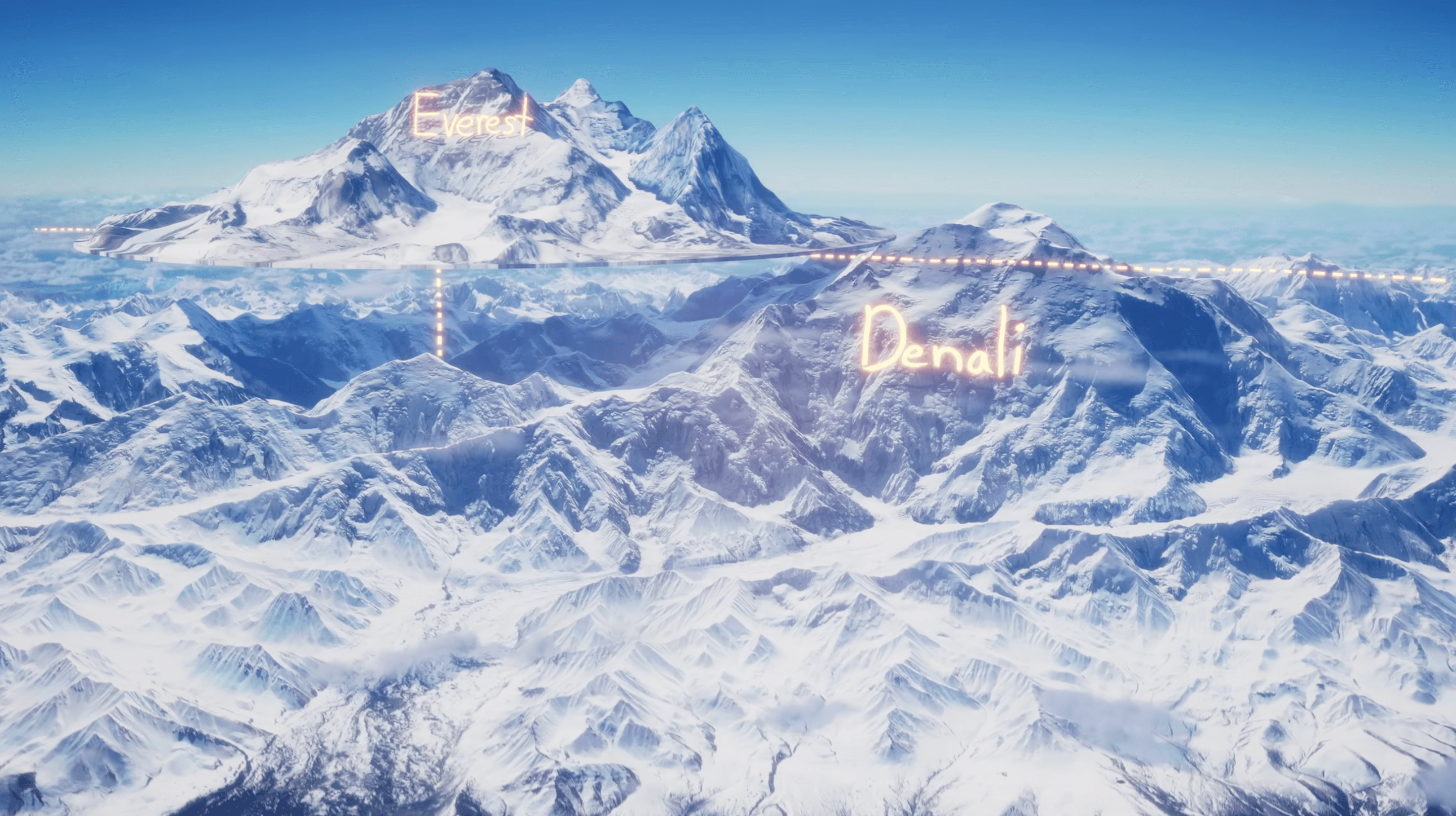
First, to set the record straight, measuring Everest from it’s base camp in the nearest valley to it’s summit.. we get a BTP height of 12,135 ft.
Since we have the world digitally mapped, we can just grab Everest from it’s base and move it around, to scale, and compare it to other mountains.
 | 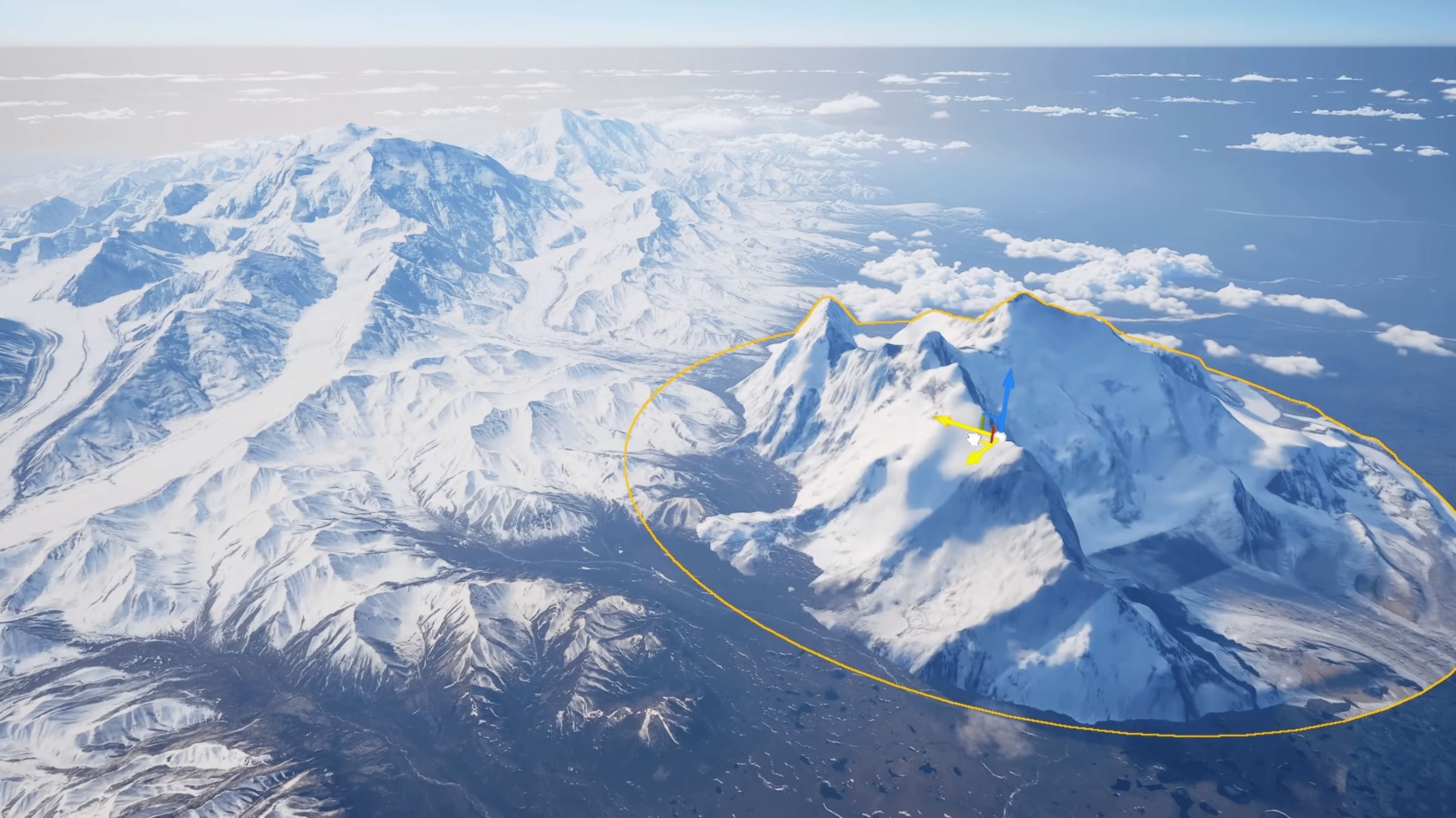 |
|---|
Lets checkout a few.
| Fuji (12,389 ft) | Matterhorn (14,692 ft) |
|---|---|
| BTP: 9,843 ft | BTP: 7,970 ft |
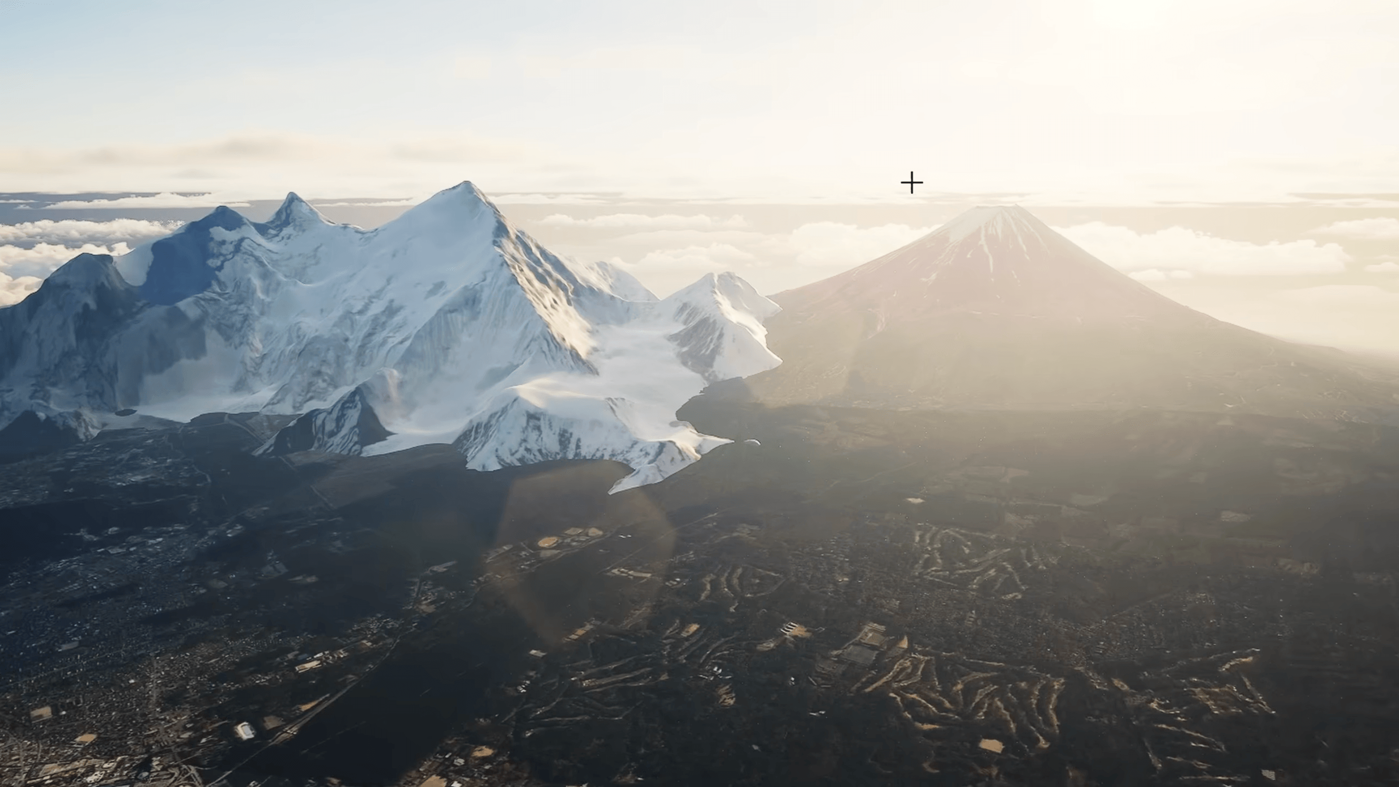 |  |
We can see that Everest is still taller than both Fuji and the Matterhorn, but not by much. A fun thing to do is to set base camp to it’s actual height - which is located at a higher elevation than every mountain in the Alps.
Let’s now compare it to my favorite type of mountain - stratovolcanos. These are special because they are typically isolated peaks, instead of belonging to a larger range - meaning they have massive reliefs.
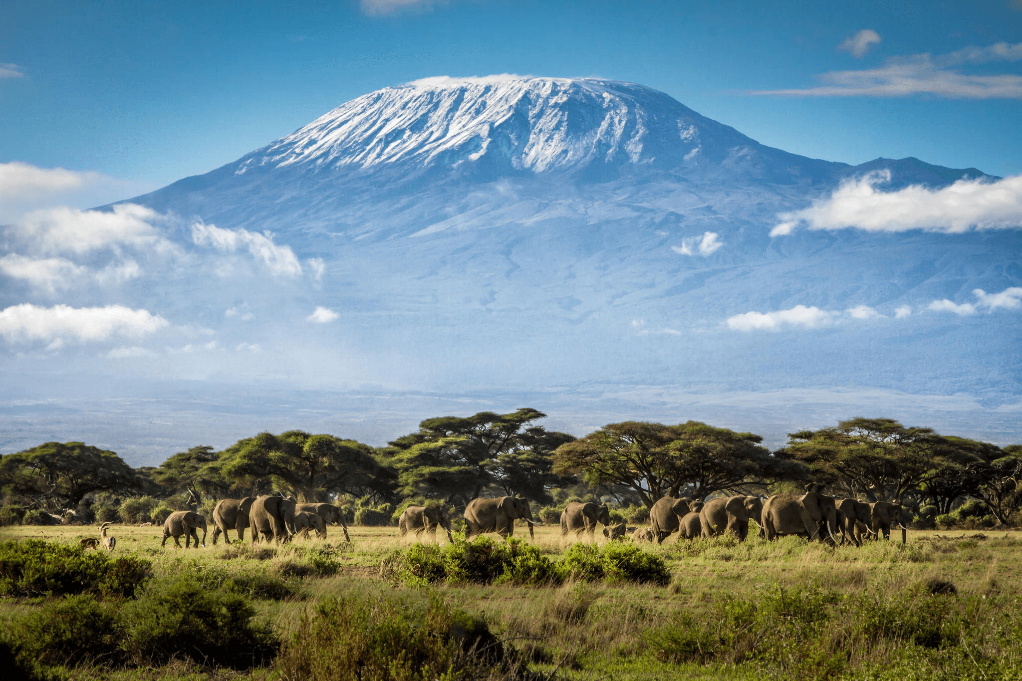
| Rainer (14,410 ft) | Kilimanjaro (19,340 ft) |
|---|---|
| BTP: 12,614 ft | BTP: 16,076 ft |
 |  |
Rainer, a peak about half of Everest’s elevation, is just barely a taller mountain measured from it’s base.
Kilimanjaro is considered the “tallest free-standing” mountain in the world - as there is nothing else around it. Everest can easily fit inside of Kilimanjaro.
But there is another mountain bigger all of the others - Denali in Alaska, meaning “The High One”.
(And no, I don’t call it “Mt. McKinley” - a politician from Ohio who never once went to Alaska.)
Denali is a already a tall mountain at over 20K ft elevation, but the lowlands around it go all the way down to 2K ft, giving it a BTP of 18k ft.
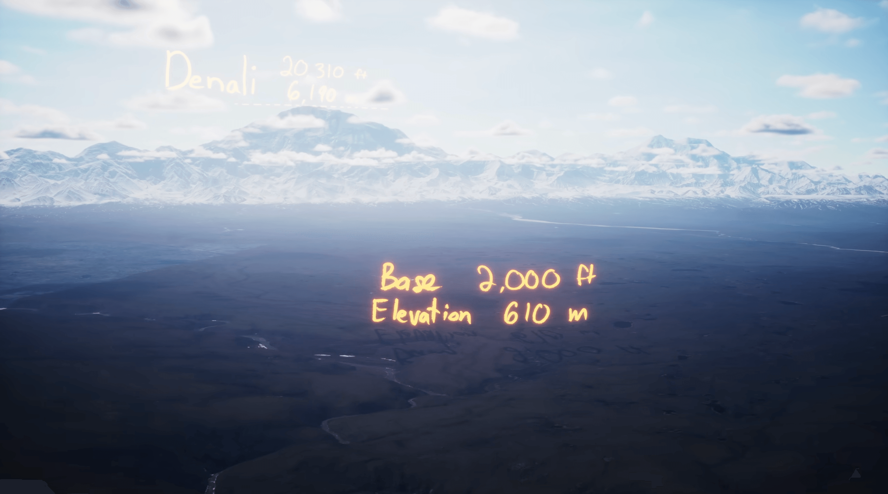
There exists some river valleys in the lowlands that get down to 200ft in elevation. There’s no where else on earth where you can visually look at something 20,000 ft above you.
And it is coherently one mountain - visually and topographically. It isn’t considered free standing as it is part of the greater Alaska Range, but it stands alone within the range.
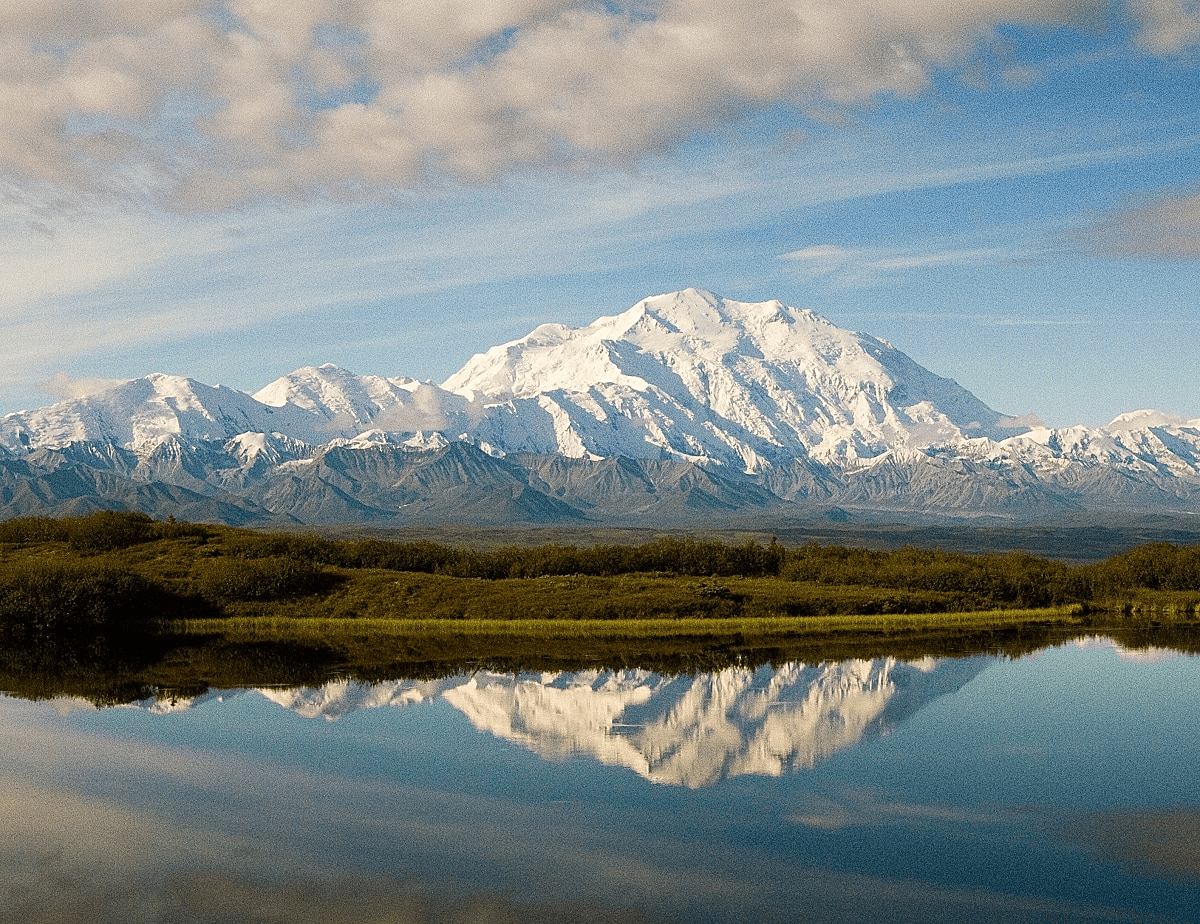
Denali is the single tallest mountain.
Whats really the Tallest?
Now that we have a better way to measure a mountain’s size, let’s compile a list of the biggest, baddest mountains on this planet. You may be surprised to see some mountains near the top that you might not know about.
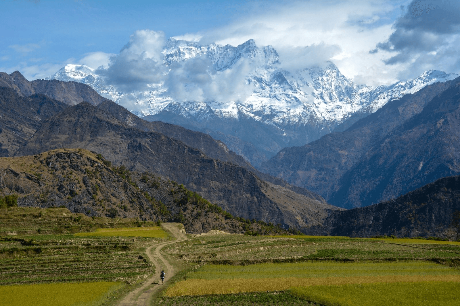
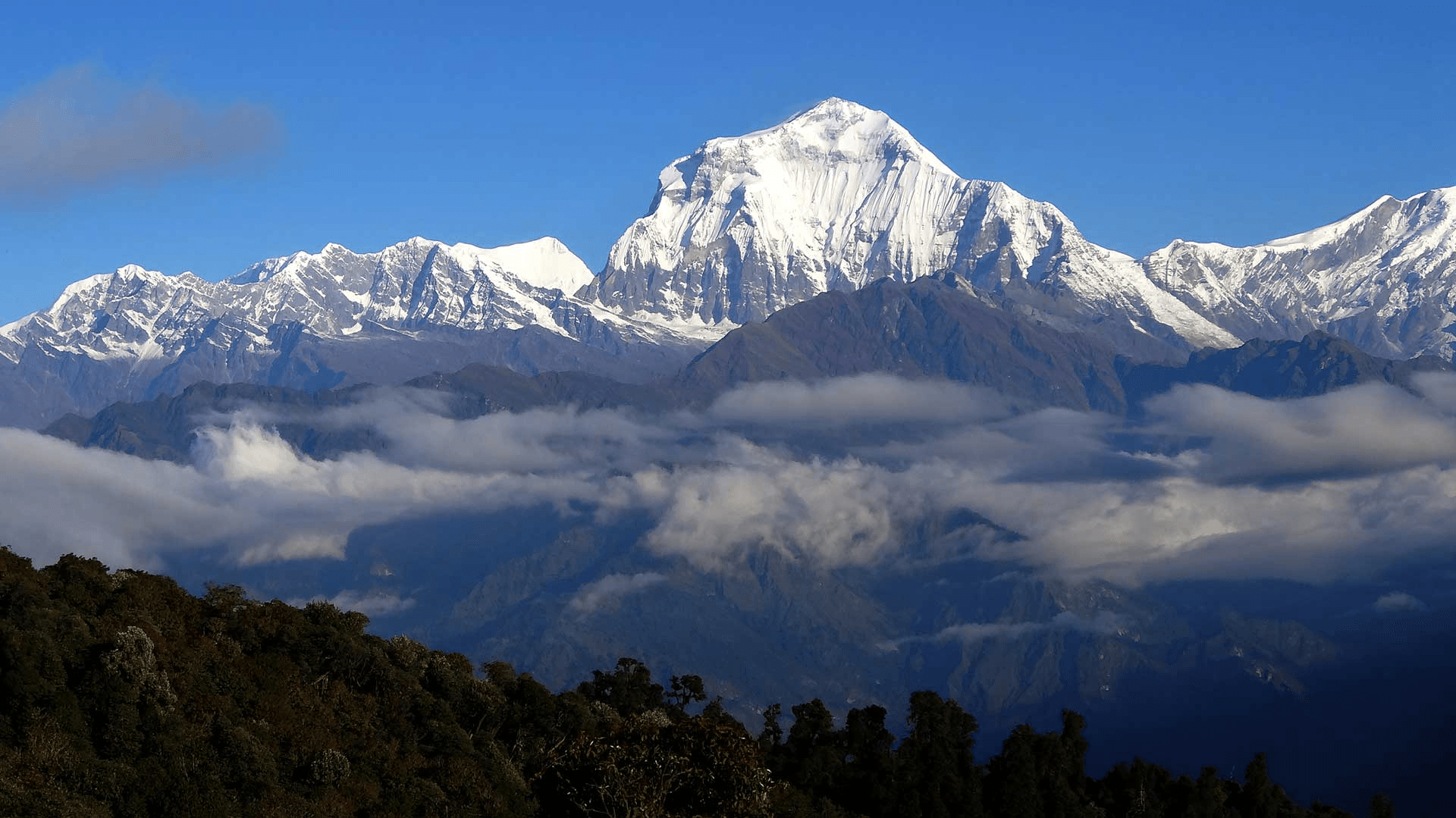
- Annapurna and Dhaulagiri in Nepal when viewed from the valley side. They are at the edge of the Tibetan plateau.
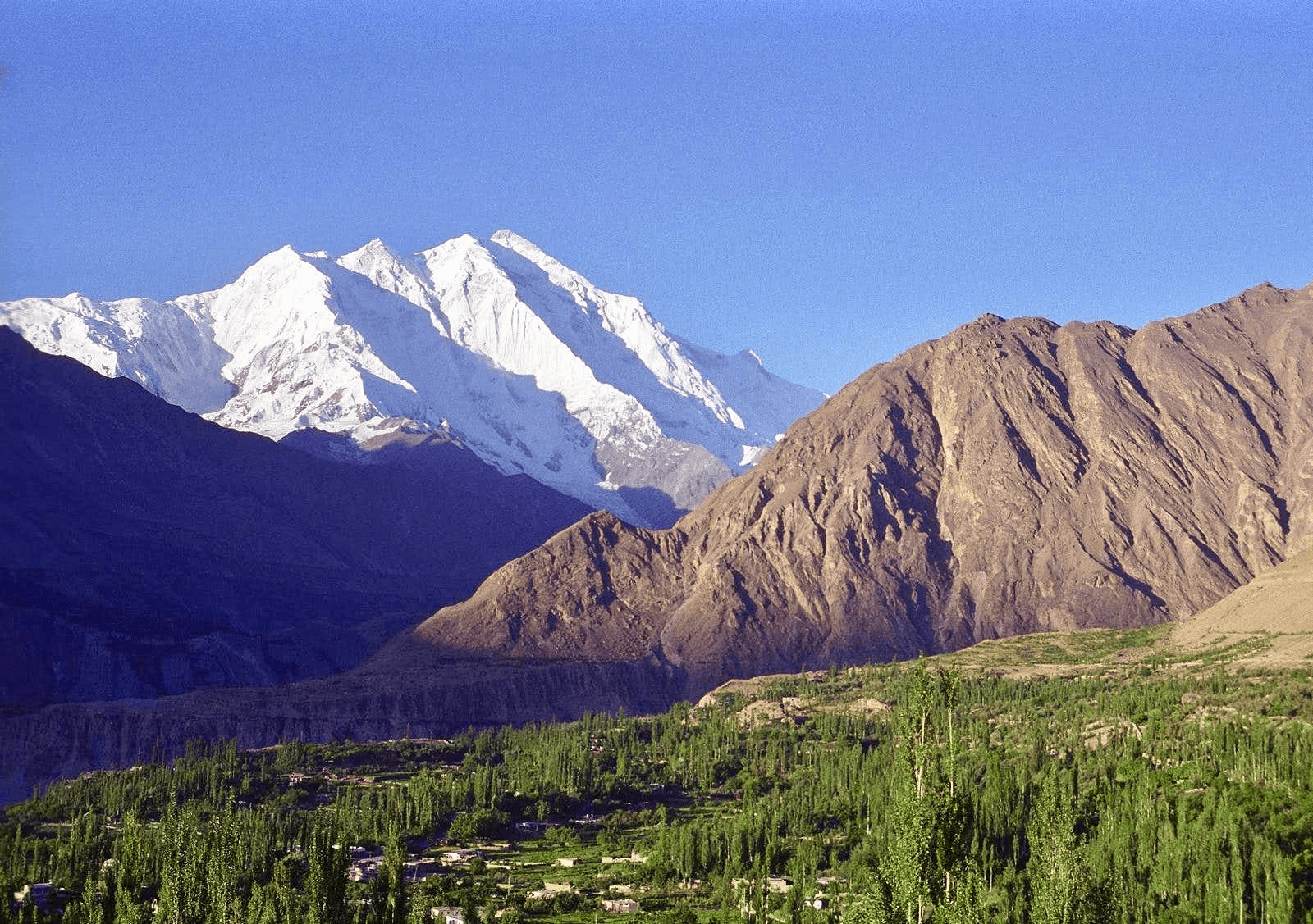
- Rakaposhi in Pakistan down to the valleys that surround it. It is surrounded by similar sized peaks.
- Kilimanjaro is free standing.
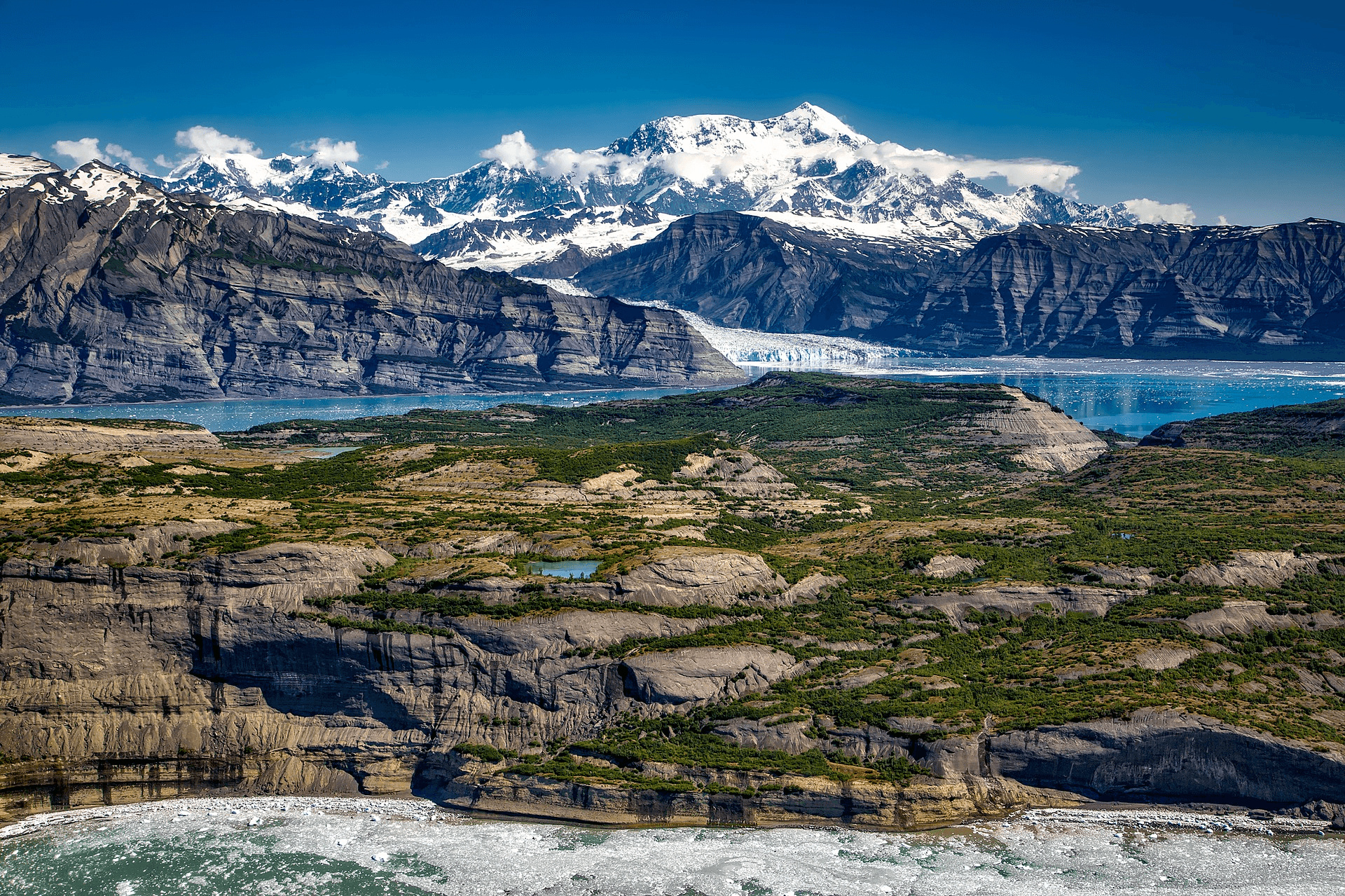
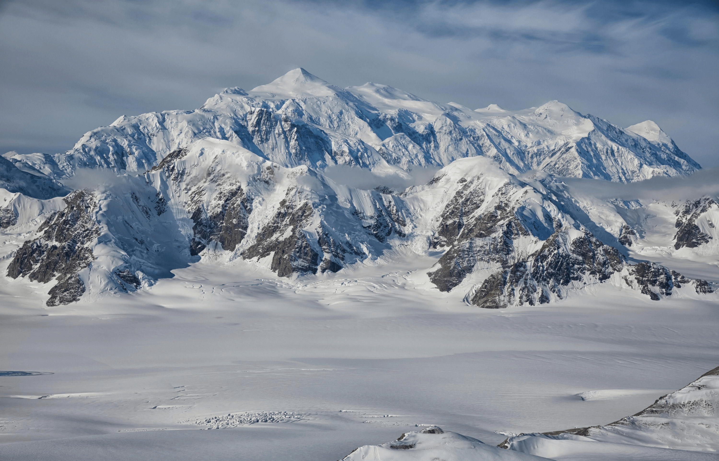
- Mt St.Elias in Canada is sometime argued to be taller than Denali, as it’s base it right at the ocean. Nearby Mt Logan is also massive.
| Annapurna | Dhaulagiri | Rakaposhi |
|---|---|---|
 |  |  |
| Kilimanjaro | Mt St.Elias | Mt Logan |
|---|---|---|
 |  |  |
All of these mountains could be argued to be taller than Denali in certain ways. So pick your favorite. For me, it’s down to Denali and Kilimanjaro for the way they rise alone from the plains around them, even though their elevations aren’t as tall as the Himalayan peaks.
Also, I’m aware the Mauna Kea in Hawaii is by far the biggest mountain on earth when measured from the sea floor, but nah. How are you going to climb that?
Ref: